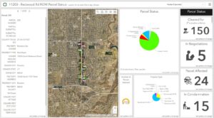
Maps change our perspective.
Maps have always helped people find things and communicate to show others how to find the same. By coupling dynamic maps with data analytics and visualization they can do so much more. This is what makes GIS so powerful. The map becomes the interface that enables users to understand complex situations and lead them to better decisions. It allows for the consumption of information that has a scale larger than words can convey.
GIS systems can record and store geographic, spatial or location information in maps along with other associated data. Analysis of spatial distribution and patterns can simplify complex problems, bring insight, fuel discovery, add context, create conversations, tell better stories and can help identify spatial or temporal trends. Maps, including dynamic and interactive maps are a visual representation of data. They present information and communicate findings, allow for sharing data or statistics in a quickly understood way, and simplify communication of situations, problems or solutions.
Communication and visualization lead to better decision making. They serve as a catalyst for insight and collaboration, process automation, better managing of operations, and process workflows, resulting in savings to budgets.
Using the latest in GIS technology will allow your project to be successful. The meteoric rise in the use of GIS for project based decisions has allowed budgets to be met, timeframes to be satisfied, and presentations to be smoother and more effective.
Contact us to see how we can enhance your project with GIS.
Frequently Asked Questions
What is GIS?
A geographic information system (GIS) is a system that creates, manages, analyzes, and maps all types of data. GIS connects data to a map, integrating location data (where things are) with all types of descriptive information (what things are like there). This provides a foundation for mapping and analysis that is used in science and almost every industry. GIS helps users understand patterns, relationships, and geographic context. The benefits include improved communication and efficiency as well as better management and decision making for Meridian projects such as track topography, parcel ownership, and coordinating right of way or acquisition efforts.
What does a GIS analyst do?
A GIS analyst uses Geographic Information System (GIS) technology in presenting spatial information in a digital format. Geographic data is gathered and organized from images and surveys while updating existing maps. Meridian GIS utilizes Python scripting to automate GIS database updates and integrate a variety of source data. This assures quality control and efficiency. Our experience in web programming has allowed for the creation of custom-designed web applications that are tailored for the client’s needs while working with custom coordinate systems and incorporating data from many different sources, including CAD, GIS, spreadsheets, GPS collection, survey points, record documents, right-of-way descriptions, tables, and databases.
Meridian Engineering’s GIS staff is diversely skilled to work with many professional disciplines. This helps us “translate” information from engineers, surveyors, IT staff, planners, project managers, and so on. We know how to manage resources when complex issues arise and understand the GIS needs for future community development. Our team has developed workflows to help us create data involving strict standards establishing spatial data availability for the client’s requirements. This data is fully attributed and ready to be used in many different systems (particularly GIS and CAD) and is readily queried and spatially analyzed.
Our workflows are automated with the use of the Python scripting language. We use ArcPy for Esri’s desktop GIS and ArcGIS API for Python in our online GIS environment. We use JavaScript, HTML, CSS, and other online programming to manipulate our custom web mapping applications. We fully understand Linear Referencing Systems (LRS) and how to prepare data to work with FME- the data integration platform.
What is the difference between GPS and GIS?
Global Positioning Systems, commonly known as GPS, are used to find an exact location on earth. GIS, which is short for geographic information systems, is a scientific system providing and reporting analytical information on geographical data.


